7 DAYS KILIMANJARO CLIMB MACHAME ROUTE
Kilimanjaro Climb Machame Route is probably the most scenic and most beautiful route to the summit you can ever choose. The day walks are longer and steeper, however the summit night is one hour shorter than the Marangu route. The scenic traverse of the Western Breach offers some stunning views! Only tented accommodation available, which can be less comfortable and will require a good sleeping bag and hiking mattress.
All climbers sleep in tents (tents are included) and meals are served in a dinner tent or on a blanket outside.Kilibound Adventures will also be providing showers in between
Kilimanjaro climb Machame route is done for 7 days, so acclimatization is easier, and the success rate is fairly high. It is mostly for physically fit people with some hiking experience. Descent is down the Mweka trail staying at the Mweka or Millennium camp the final night on the mountain.
DAY 1: DRIVE TO KILIMANJARO NATIONAL PARK MACHAME GATE, HIKE TO MACHAME CAMP
Drive from Moshi a nearest town where you will be picked to Machame Gate takes about 45 minutes. The journey passes through the village of Machame which is located on the lower slopes of the mountain.
We depart the park gate and walk through the rain forest on a winding trail up a ridge. At lower elevations the trail can be muddy and slippery. Gaiters and trekking poles are a good idea here. We continue a short distance until we reach the Machame Camp.
- Elevation: 1830m/6000ft to 3050m/9950ft
- Distance: 11km/7mi
- Hiking Time: 5-6 hours
- Habitat: Montane Forest
- Meals: LD
DAY 2: MACHAME CAMP TO SHIRA CAMP
After breakfast we leave the glades of the rain forest and continue on an ascending path, crossing the valley along a steep rocky ridge. The route now turns west onto a river gorge until we arrive at the Shira campsite.
- Elevation: 3050m/9950ft to 3850m/12,600ft
- Distance: 5km/3mi
- Walking Time: 4-5 hours
- Habitat: Moorland
- Meals: BLD
DAY 3: SHIRA CAMP TO LAVA TOWER TO BARRANCO CAMP
From the Shira Plateau we continue to the east up a ridge, passing the junction towards the peak of Kibo. As we continue, our direction changes to the South East towards the Lava Tower, called the “Shark’s Tooth” (elev 4650m/15,250ft). Shortly after the tower we come to the second junction which goes to the Arrow Glacier. We now continue down to the Barranco Camp. Although you end the day around the same elevation as when you began, this day is very important for acclimatization and will help your body prepare for a summit day.
- Elevation: 3850m/12,600ft to 4000m/13,000ft
- Distance: 10km/6mi
- Walking Time: 5-6 hours
- Habitat: Semi-desert
- Meals: BLD
DAY 4: BARRANCO CAMP TO KARANGA CAMP
After breakfast, we leave Barranco and continue on a steep ridge up the Barranco Wall (elev 4250m/13,900ft), through the Karanga Valley (elev 4050m/13,250ft) to the junction which connects with the Mweka Trail. Then we climb this non-technical but steep, nearly about 900 ft cliff. From the top of Barranco Wall we will cross a series of hills and valleys until we descend sharply into Karanga Valley. One more stapes climb up leads us to Karanga Camp. This is a shorter day meant for acclimatization.
- Elevation: 4000m/13,044ft to 4700m/13,106ft
- Distance: 5km/3mi
- Hiking Time: 4-5 hours
- Habitat: Alpine Desert
- Meals: BLD
DAY 5: KARANGA CAMP TO BARAFU CAMP
We leave Karanga and hit the junction which connects with the Mweka Trail. We continue up to the rocky section to Barafu Hut. At this point, you have completed the Southern Circuit, which offers views of the summit from many different angles. Here we make camp, rest and enjoy an early dinner to prepare for the summit day. The two peaks of Mawenzi and Kibo are viewable from this position.
- Elevation: 13,106 ft to 15,331 ft
- Distance: 4 km/2 miles
- Hiking Time: 4-5 hours
- Habitat: Alpine Desert
DAY 6: BARAFU CAMP TO SUMMIT, DOWN TO MWEKA CAMP
Very early in the morning (midnight to 2 am), we continue our way to the summit between the Rebmann and Ratzel glaciers. You ascend in a northwest direction and ascend through heavy scree towards Stella Point on the crater rim. This is the most mentally and physically challenging portion of the trek. At Stella Point you will stop for a short rest and will be rewarded with the most magnificent sunrise you are ever likely to see. Faster hikers may view the sunrise from the summit.
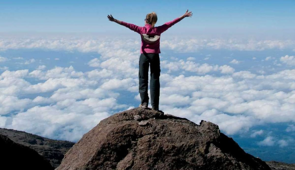
From Stella Point, you may encounter snow all the way on your 1-hour ascent to the summit. Once at Uhuru Peak you have reached the highest point of the continent of Africa, meaning top of the Kilimanjaro.
From the summit we begin our descent by continuing straight down to the Mweka Camp, stopping at Barafu for lunch. You may want gaiters and trekking poles for the loose gravel going down. We arrive at Mweka Camp and enjoy our last evening on the mountain.
- Elevation: 4700m/15,350ft to 5895m/19,340ft
- Down to 3090m/10,150ft
- Distance: 5km/3mi up / 13km/8mi down
- Hiking Time: 5-7 hours up / 5-6 hours down
- Habitat: Stone scree and ice-capped summit
- Meals: BLD
DAY 7: MWEKA CAMP TO MWEKA GATE, DRIVE TO MOSHI
After breakfast we continue the descent down to the Mweka Park Gate to receive your summit certificates. At lower elevations, it can be wet and muddy. Gaiters and trekking poles will help. Shorts and t-shirts will probably be plenty to wear (keep rain gear and warmer clothing handy).
Your vehicle will be waiting for you at Mweka gate to drive you back to your hotel in Moshi and this will mark the end of Kilimanjaro Climb Machame Route with Kilibound Adventures.
- Elevation: 3090m/10,150ft to 1680m/5500ft
- Distance: 10km/6mi
- Hiking Time: 3-4 hours
- Habitat: Forest
- Meals: B
PRICE:
Ask for Price
Why Ask for Price?
- We offer Private and Tailor-Made Safari Tours
- Price varies according to Seasons i.e High Season and Low Season
- Price can be reduced due to the number of people travelling
- The price depends on accommodation standards i.e Budget Camping, Standard Lodges, or Luxury Accommodation
Thank you for working with Kilibound Adventures Karibu Tena.
[wptripadvisor_usetemplate tid=”1″]